Land of Moab: Location, History, and Biblical Significance
Land of Moab: Location, History, and Biblical Significance
The land of Moab was an ancient kingdom east of the Dead Sea, mostly in what is now west-central Jordan. Its territory centered on a high plateau between the Arnon River and the Zered Valley, although its borders changed over time and are not always defined consistently in ancient sources.
Moab appears throughout the Bible as the homeland of the Moabites, a people related to Israel through Lot’s family. The region is associated with the plains opposite Jericho, the story of Ruth, King Mesha, the prophet Balaam, and the final stage of Moses’ life before Israel entered Canaan.
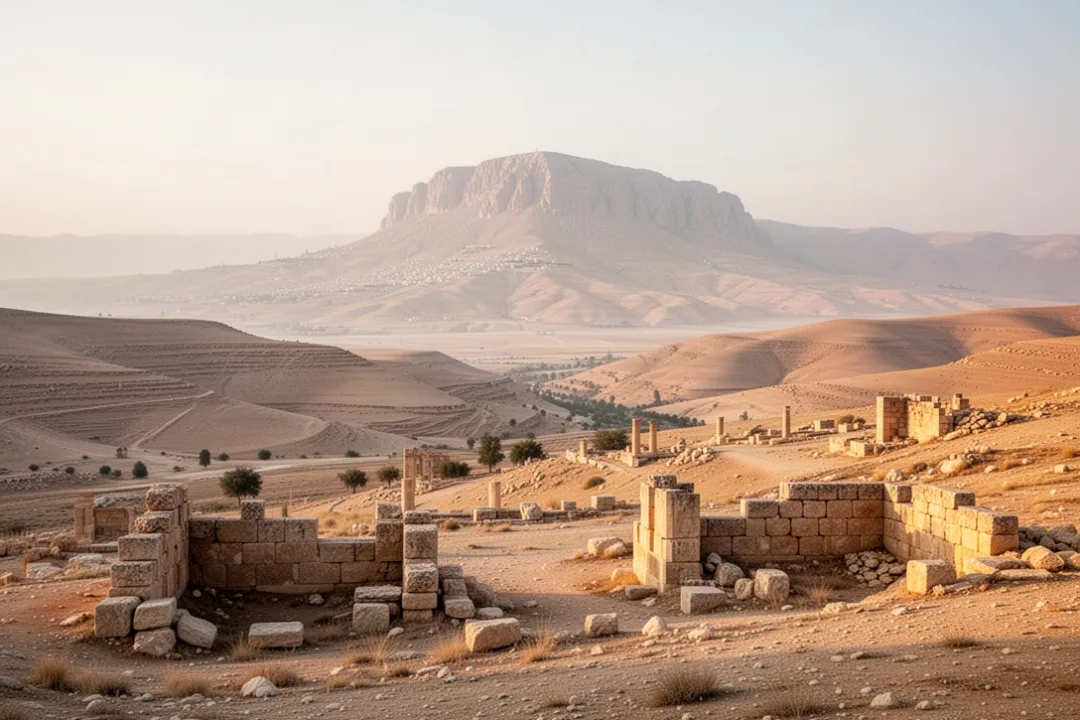
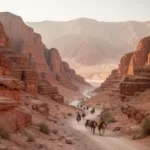
Moab occupied the highlands on the eastern side of the Dead Sea. From this elevated country, the land drops sharply westward toward the sea and the Jordan Valley. Much of the region consists of dry tablelands, deep wadis, fertile pockets, and broad views across the Dead Sea toward the Judean hills.
In broad geographical terms, the kingdom stretched from the Arnon Gorge in the north to the Zered Valley in the south. The Arnon, identified with the modern Wadi Mujib, was one of the most significant natural features in the area. The Zered Valley, often associated with Wadi al-Hasa, marked a southern limit in several biblical descriptions.
The western edge faced the Dead Sea. The eastern boundary was less precise because the landscape opens toward desert routes and neighboring territories. Moab’s control also expanded and contracted, so the phrase “land of Moab” can refer to a political kingdom, a cultural region, or the broader homeland of the Moabite people.
Geographical caution: Ancient borders were not fixed like modern national boundaries. Biblical references to Moab may describe different periods, and some passages use the name for a smaller or broader area than the central Moabite plateau.
How to identify the land of Moab on a map
A useful way to locate Moab is to move through the region from west to east and north to south. This avoids treating the kingdom as a single precisely measured rectangle and reflects the varied evidence from the Bible, archaeology, and ancient inscriptions.
Start at the Dead Sea. Moab lay on the eastern side of this inland salt lake, opposite parts of Judah and the Jordan Valley.
Find the central plateau. The main Moabite heartland was the elevated country east of the Dead Sea, including areas around Dibon, Medeba, and Kir-hareseth or Kerak.
Locate the northern reference point. The Arnon Gorge formed a major boundary in several descriptions, separating Moab from territories farther north.
Trace the southern limit. The Zered Valley is commonly associated with the southern edge of Moabite territory.
Look toward the eastern desert. Moab connected with caravan routes leading toward the Arabian and Syrian deserts, though political control in this direction varied.
Separate Moab from Ammon. Ammon generally lay farther north and northeast, around the region of modern Amman, while Moab occupied the plateau closer to the Dead Sea.
Modern travelers often associate the biblical land of Moab with the area around Madaba, Mount Nebo, Dhiban, and Kerak. These places do not represent the whole kingdom, but together they help explain its location and historical importance.
The physical landscape that shaped Moabite life
Moab’s geography was both harsh and productive. The plateau receives more rainfall than the desert farther east, allowing communities to grow grain and maintain orchards when water was available. At the same time, steep valleys and limited permanent water made settlement dependent on springs, cisterns, seasonal streams, and careful farming.
The western escarpment gave Moab a strong defensive position. Anyone approaching from the Dead Sea or Jordan Valley had to climb through difficult terrain, while settlements on the plateau could watch important roads and passes. This location also gave Moab access to routes running north and south along the plateau.
Several environmental features shaped the kingdom:
Deep wadis: Gorges such as the Arnon created natural boundaries and difficult travel corridors.
Elevated farmland: The plateau supported cereals, grazing, vineyards, and other crops in suitable areas.
Desert margins: The eastern edge connected Moab to trade and pastoral routes but also exposed it to raids and shifting alliances.
Mountain passes: Roads through the escarpment linked the plateau with the Dead Sea and Jordan Valley.
Strategic hilltops: Fortified settlements could monitor movement across wide sections of the landscape.
The name Moabite plateau is useful because it emphasizes the region’s elevation. Moab was not simply a narrow strip beside the Dead Sea; its principal settlements stood in the higher country east of the shoreline.
Who the Moabites were
The Moabites were an ancient West Semitic people who established a kingdom east of the Dead Sea. In the Bible, they are presented as relatives of the Israelites through Lot, Abraham’s nephew. Genesis 19 gives a family-based explanation for Moab’s origin, but the story also reflects the close yet frequently hostile relationship between the two neighboring peoples.
Moabite culture was related to that of surrounding societies, including Israel, Edom, Ammon, and other peoples of the southern Levant. The Moabites spoke Moabite, a language closely related to Hebrew and other Northwest Semitic languages. The surviving Moabite inscription is especially valuable because it provides direct evidence from the kingdom itself rather than only descriptions by neighboring writers.
The chief Moabite deity named in surviving evidence was Chemosh. The Mesha Stele presents Chemosh as the national god who granted victory and territory to the Moabite king. Biblical passages also identify Chemosh with Moab, although the biblical authors describe Moabite worship from the standpoint of Israelite religious belief.
Moabite identity involved more than political borders. It included language, religious practice, local traditions, family networks, agricultural communities, and loyalty to rulers who controlled fortified centers. As with other ancient kingdoms, the population probably included farmers, pastoralists, merchants, soldiers, priests, and people living under different degrees of royal authority.
Moab in the Bible’s earliest geographical accounts
The Bible’s early references place Moab within a complicated political landscape. Deuteronomy 2 describes the Moabites as descendants of Lot and distinguishes their land from the territories Israel was permitted to take. This passage suggests that the biblical writers recognized Moab as a people with an established homeland rather than treating the region as unclaimed territory.
Numbers 21 describes Israel’s approach from the wilderness and records conflicts with Sihon, king of the Amorites. According to the account, Israel defeated Sihon and took land north of the Arnon. The passage is easy to oversimplify, but it does not present Israel as conquering all of Moab. Instead, it describes a shifting frontier in which Amorite control had already affected territory associated with Moab.
Numbers 22–24 places the Israelites in the plains of Moab, near the Jordan River and opposite Jericho. This is one of the most important locations connected with the name. The plains were not necessarily the same as the central Moabite plateau; they were lowland areas near the Jordan, traditionally associated with the final encampment before Israel crossed into Canaan.
From this position, Balak, king of Moab, sought help against Israel by calling Balaam. The narrative describes attempts to bring a curse against Israel, followed by blessings instead. It also depicts negotiations, sacrifices, and political anxiety, showing Moab as an organized kingdom able to respond to a large population moving near its borders.
Deuteronomy 34 places Moses on Mount Nebo, where he viewed the land west of the Jordan before his death.
The reference to Mount Nebo is particularly important for geography. The mountain belongs to the Moabite highlands and provides a natural viewpoint over the Jordan Valley and the hills of Canaan. The location links Moab not only with conflict but also with the closing scenes of the wilderness period.
The relationship between Moab and Israel
Relations between Moab and Israel changed from one period to another. The two peoples shared geographic proximity and ancestral traditions, but they also competed for land, influence, tribute, and control of travel routes. Biblical narratives therefore present both conflict and cooperation.
The book of Judges describes Moabite control over parts of Israel during the rule of Eglon, a Moabite king. The story of Ehud’s assassination of Eglon and the subsequent Israelite revolt is told from an Israelite perspective, but it indicates that Moab could project power west of the Dead Sea and into the Jordan Valley.
During the period of the united monarchy, David fought neighboring peoples, including Moab. The account in 2 Samuel reports a Davidic victory over Moab, although the details and historical circumstances are debated. Moab’s political position may have changed repeatedly as Israel, Judah, Aram, Edom, and other powers competed for influence.
Later, the Moabite king Mesha rebelled against Israel. The event is recorded in 2 Kings 3 and also in the Mesha Stele, making it one of the rare episodes in the Hebrew Bible that has a related inscription from the opposing kingdom. The two accounts differ in purpose and emphasis, but both connect Mesha with a major struggle over Moabite territory and tribute.
Read the sources together: Biblical narratives explain events through Israel’s religious and political history, while the Mesha Stele presents Moabite royal ideology. Neither source should be treated as a neutral modern report, but their comparison reveals how both kingdoms remembered the conflict.
The Mesha Stele and what it reveals about Moab
The Mesha Stele, often called the Moabite Stone, is the best-known inscription connected with the kingdom. It was created during the reign of King Mesha, generally placed in the ninth century BCE. The inscription was found at Dhiban, the ancient city of Dibon, in the Moabite heartland.
Mesha describes himself as a king who restored territory and buildings for Chemosh. He claims to have defeated Israel and recovered towns that had been under Israelite control. The inscription also mentions several places known from biblical geography, including Dibon and Nebo, making it valuable for reconstructing the region’s political map.
The stele offers several kinds of evidence:
Political evidence: It identifies Mesha as a ruler who organized resistance against Israel.
Religious evidence: It credits Chemosh with victories and royal authority.
Geographical evidence: It names towns and territories in or near the Moabite kingdom.
Linguistic evidence: Its language demonstrates the close relationship between Moabite and Hebrew.
Architectural evidence: It refers to construction and restoration projects associated with royal power.
The inscription is not a complete history of Moab. Royal monuments commonly emphasize victory, divine favor, and the king’s achievements. Still, its value is exceptional because it gives a Moabite voice to a period otherwise known mainly through neighboring traditions.
Important places within the land of Moab
Dibon
Dibon, usually identified with modern Dhiban, was one of Moab’s major centers. It became the place where the Mesha Stele was discovered and is closely connected with King Mesha’s rule. The city’s location on the plateau made it useful for administration, farming, defense, and movement across the kingdom.
Medeba
Medeba, or modern Madaba, stood north of the central Moabite heartland. It appears in biblical and inscriptional discussions of the region and later became famous for its Byzantine-period mosaic map. That later map is not a Moabite document, but the city’s continued importance reflects the strategic value of the plateau.
Mount Nebo
Mount Nebo is associated with Moses’ view of Canaan in Deuteronomy 34. The mountain’s elevation provides a broad outlook over the Dead Sea, the Jordan Valley, and the hills west of the river. Its biblical importance comes from the final scenes of Moses’ life, but its geography also explains why high points in Moab mattered for observation and defense.
Kerak and Kir-hareseth
Kerak, a major stronghold in modern Jordan, is often associated with the biblical place called Kir-hareseth or Kir-hareseth. The identification is not entirely free from scholarly debate, but the area belongs to the southern Moabite zone and later remained strategically important. Ancient references portray the city as a fortified center.
The Arnon Gorge
The Arnon was both a geographic landmark and a political boundary. Its deep channel cut through the plateau before reaching the Dead Sea. Biblical references use the Arnon to describe the edges of Israelite, Amorite, and Moabite territory, although the exact political control of areas around the gorge changed over time.
Ruth’s connection to the land of Moab
The book of Ruth begins with an Israelite family leaving Bethlehem during a famine and settling in Moab. After the deaths of her husband and sons, Ruth chooses to return to Judah with Naomi. Her identity as a Moabite woman remains central to the story, especially because she becomes part of the family line associated with David.
Ruth’s story presents Moab in a different way from the war narratives. The land is a place of residence, marriage, grief, loyalty, and migration. It also shows that biblical attitudes toward Moab were not presented in one simple voice: legal and military traditions could be wary of Moab, while the story of Ruth gives a Moabite woman an honored place in Israel’s royal ancestry.
The text does not provide a detailed map of Ruth’s home, and it should not be used to identify a specific town without further evidence. Its geographical value lies in showing that movement between Judah and Moab was possible and that family and economic ties crossed the Dead Sea region.
How archaeology helps reconstruct Moab
Archaeology has identified settlements, fortifications, roads, religious remains, agricultural installations, pottery, inscriptions, and other evidence across the Moabite plateau. These discoveries help researchers understand how people lived rather than relying only on royal or biblical accounts.
Ancient settlements in the region often occupied defensible elevations near cultivable land and water sources. Archaeologists examine the layout of walls, gates, houses, storage spaces, temples, and administrative buildings to determine how communities were organized. Cisterns and terraces reveal the practical strategies used to manage irregular rainfall.
Pottery styles and building methods can help establish patterns of trade and cultural connection. Because Moab stood between settled agricultural lands and desert routes, its material culture reflects interaction with neighboring societies. Imported objects may indicate long-distance exchange, while local wares can reveal regional production and changing habits.
Archaeological evidence also has limits. Excavated sites represent only a small portion of the ancient landscape, and many remains have been damaged by erosion, later construction, looting, or modern development. The absence of evidence at one location does not automatically prove that a settlement or event never existed.
Moab’s economy, roads, and political importance
Moab’s economy depended heavily on agriculture and pastoralism. The plateau could produce grain in favorable areas, while herding used lands less suitable for intensive cultivation. Vineyards, orchards, and local craft production may also have supported communities and royal centers.
Control of roads added to the kingdom’s importance. Routes connected the highlands with the Dead Sea, the Jordan Valley, Edom, Ammon, and desert regions farther east. A kingdom that controlled passes and settlements could collect tribute, protect caravans, or threaten neighboring territory.
Royal power likely depended on a network of fortified centers rather than on constant control of every part of the plateau. Kings needed to mobilize soldiers, store food, maintain walls, and negotiate with local leaders. The Mesha Stele’s emphasis on rebuilding towns reflects how construction could demonstrate authority after a period of foreign domination.
Moab’s location also made it vulnerable. Stronger neighbors could invade through the valleys or pressure the plateau from multiple directions. Drought, internal disputes, and changing trade routes would have placed additional strain on the kingdom. Its history therefore reflects both the advantages and risks of occupying a strategically exposed highland corridor.
What happened to the Moabites?
Moab did not disappear in a single known event. Like other ancient kingdoms, it was affected by changing empires, warfare, migration, economic shifts, and the gradual integration of local populations into larger political systems. Later references to Moab and Moabites become less frequent, but the region continued to be inhabited and contested.
Assyrian imperial records mention peoples and rulers from the southern Levant, including Moabite kings in some periods. These references show that Moab remained part of the international politics of the Iron Age, often paying tribute or negotiating with stronger imperial powers.
After the Iron Age, the area passed through different political and cultural settings. Persian, Hellenistic, Nabataean, Roman, Byzantine, and Islamic periods each left traces in the landscape. The later history of the plateau should not be confused with the biblical kingdom, but it explains why ancient Moabite sites often contain layers from many centuries.
The modern region is part of Jordan. Contemporary communities, roads, farms, and towns occupy a landscape where ancient ruins stand alongside later buildings and cultivated fields. Visiting the area requires attention to the fact that “Moab” is an ancient historical term, not the name of a current political state.
Why the land of Moab matters for biblical geography
Moab helps readers connect biblical narratives with a real landscape. The name appears in stories involving wilderness travel, neighboring kingdoms, prophetic encounters, family migration, royal conflict, and Moses’ final view of Canaan. These episodes become easier to understand when Moab is pictured as a high plateau east of the Dead Sea rather than as a vague distant country.
The region also demonstrates why biblical geography requires care. A single name may refer to a kingdom, a people, a district, or a remembered homeland. Boundaries could shift after conquest, and writers might describe the same area according to different political periods.
For a reliable mental picture, remember these points:
Moab was east of the Dead Sea, primarily in modern Jordan.
The central plateau was the kingdom’s main geographic setting.
The Arnon and Zered valleys are commonly used to describe northern and southern limits.
The plains of Moab were associated with Israel’s encampment near the Jordan opposite Jericho.
Mount Nebo stood in Moab’s highlands and is linked with Moses’ final view.
Dibon and Mesha provide some of the clearest historical and archaeological connections to the Moabite kingdom.
Seen this way, the land of Moab was a strategically placed highland kingdom with its own language, religion, political traditions, and cultural identity. Its proximity to Israel produced repeated conflict, but the evidence also shows a region connected by trade, migration, shared languages, and overlapping historical experience.
How to study Moab without confusing biblical periods
Start by separating the different kinds of evidence. A biblical narrative may describe Moab from a theological or literary perspective, an inscription may celebrate a king’s victories, and archaeology may reveal ordinary settlement patterns that neither source discusses.
Then identify the period being discussed. The Moab associated with the wilderness narratives is not automatically identical in political boundaries to the Moab ruled by Mesha centuries later. References from the monarchy, prophetic books, and later historical periods should be placed on a timeline rather than blended together.
A practical study sequence is:
Locate the terrain using the Dead Sea, Arnon Gorge, Zered Valley, Jordan River, and Mount Nebo.
Read the biblical references by period, especially the wilderness, judges, monarchy, and Ruth narratives.
Compare royal perspectives by setting 2 Kings 3 beside the Mesha Stele.
Check place-name variations, since ancient names may have several spellings or uncertain modern identifications.
Use archaeology carefully, distinguishing physical evidence from later interpretation.
Keep modern Jordan separate from ancient Moab, while recognizing that many ancient sites remain within the same broad landscape.
This approach preserves both the historical setting and the complexity of the evidence. The land of Moab was not merely a backdrop for biblical stories; it was a living kingdom whose geography shaped its agriculture, defense, politics, worship, and relationships with its neighbors.
Frequently asked questions
Is the land of Moab in modern Jordan?
Yes. The ancient land of Moab was mainly in west-central Jordan, east of the Dead Sea. Its core territory occupied the elevated plateau between the Arnon Gorge and the Zered Valley. The exact boundaries varied by period, and some biblical references use Moab for areas beyond the kingdom’s central heartland, including the plains near the Jordan opposite Jericho.
What is Moab called today?
Moab is not the name of a modern country or province. The ancient region lies within Jordan, especially around areas associated with Dhiban, Madaba, Mount Nebo, and Kerak. Modern towns and administrative borders do not match the boundaries of the biblical kingdom, so “Moab” remains a historical and geographical term.
What was the main city of Moab?
Dibon, identified with modern Dhiban, was one of Moab’s most important centers and the capital associated with King Mesha. The Mesha Stele was discovered there. Other significant places included Medeba, Mount Nebo, and the southern stronghold often connected with Kir-hareseth, although some ancient place identifications remain debated.
Are Moabites and Israelites related?
In the biblical account, Moabites and Israelites were related through Lot and Abraham’s family. Their relationship was marked by both kinship and conflict. They shared a broader cultural and linguistic environment, but they formed separate peoples with distinct political identities and religious traditions. The story of Ruth also presents a Moabite woman becoming part of David’s family line.






Leave a Reply