Location of Capernaum, Israel: Map, History, and Access
Location of Capernaum, Israel: Map, History, and Access
Capernaum is on the northwestern shore of the Sea of Galilee in northern Israel. The ancient village sits in the historic region of Galilee, near the modern communities of Tabgha and Ginosar. Its location is best known for its connection with Jesus’ Galilean ministry and for the substantial archaeological remains preserved beside the lake.
The site is not inside the modern city of Tiberias, although Tiberias is the largest nearby tourist base. Capernaum lies roughly along the northern lakeshore, several miles from the lake’s northeastern end and within easy reach of other important Christian pilgrimage sites. Visitors generally reach it by road from Tiberias, from the Jordan Valley, or from northern Galilee.
Ancient Capernaum was built on a narrow strip of land along the lake’s northwestern coast. The settlement occupied a practical position beside the water, with the surrounding hills of Galilee rising inland. This setting provided access to fishing, agriculture, regional roads, and travel across the lake.
On a modern map, look for Capernaum between Tabgha to the west and the northeastern part of the Sea of Galilee to the east. The archaeological area is close to the shoreline, although the exact waterline has changed over time. The site’s low elevation and lakeside setting help explain why ancient residents depended heavily on fishing and trade.
Capernaum is commonly associated with the northern shore rather than the eastern or southern shore. That distinction matters because the Sea of Galilee is surrounded by several sites connected with the New Testament, including Tiberias on the western side, Kursi on the eastern shore, and Magdala farther southwest.
Map clue: Search for “Capernaum National Park” or “Capernaum, Kfar Nahum” rather than relying only on the English village name. Digital maps may display several nearby religious compounds and parking areas.
How far Capernaum is from nearby places
Capernaum is close to several major attractions, making it easy to include in a northern Sea of Galilee itinerary. Distances can vary depending on the route, traffic, road closures, and the entrance or parking area used, so treat approximate travel times as planning guides rather than guarantees.
Tiberias: Capernaum is generally reached by following the northern lakeshore road from Tiberias. The drive usually takes under an hour in normal conditions.
Tabgha: This major Christian pilgrimage area is immediately west of Capernaum, making it practical to visit both sites on foot only for some travelers or by a short drive.
Mount of Beatitudes: The site traditionally associated with the Sermon on the Mount is inland and west of Capernaum, reached by a short road journey.
Magdala: Magdala is farther southwest along the western shore and can be combined with Capernaum during a full-day lakeside route.
Nazareth: Nazareth is west of the Sea of Galilee, across the Lower Galilee hills. Travel time depends considerably on traffic and the selected road.
Safed: Safed is northwest of the lake in the Upper Galilee hills. The roads are scenic but winding in places.
The road network around the lake is straightforward in broad terms, but public transportation is less convenient than a private car or organized tour. A taxi or guide can save time when visiting several sites in one day. Travelers staying in Tiberias often use the city as a base because it has the broadest selection of accommodations and services in the immediate area.
Why Capernaum is called Kfar Nahum
The name Capernaum comes through Greek and Latin forms of the Hebrew name Kfar Nahum, usually understood as “village of Nahum.” The modern Hebrew name is often written Kfar Nahum or Kefar Nahum. Seeing different spellings does not indicate different locations; they refer to the same ancient settlement and archaeological site.
Ancient sources identify Capernaum as a village in Galilee. The settlement appears in the New Testament under the Greek form of its name, while archaeological and modern Israeli references commonly use Kfar Nahum. Maps, road signs, tour materials, and guidebooks may use one form or both.
The distinction is useful when planning a visit. A search for only “Capernaum Israel” will normally produce the correct destination, but including Kfar Nahum can help when checking Hebrew-language maps, local directions, or transportation information.
What remains at the Capernaum archaeological site
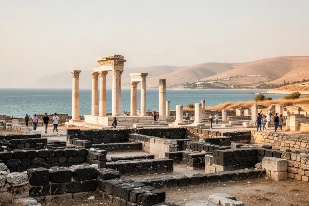
The archaeological site preserves the remains of a village that grew during the Second Temple period and continued through the Byzantine era. Excavations have uncovered domestic buildings, public structures, streets, and religious remains. The ruins show that Capernaum was more substantial than a temporary fishing camp.
Many of the village houses were constructed from local black basalt, a volcanic stone common in the region. The dark walls and foundations are one of the site’s most recognizable visual features. In contrast, the nearby ancient synagogue contains carefully cut, lighter-colored limestone elements, creating a striking difference in materials.
The settlement’s layout offers clues about daily life. Homes were grouped around courtyards, where families could work, cook, store goods, and carry out household tasks. The remains are not preserved as complete standing houses, but the foundations and reconstructed sections help visitors imagine the density of the village.
Archaeologists have also found evidence connected with fishing and domestic activity. Because Capernaum stood beside the lake, residents could combine fishing with small-scale farming, craft work, and local commerce. Its position near routes through Galilee gave it importance beyond its physical size.
The ancient synagogue and its historical setting
The synagogue at Capernaum is one of the site’s most prominent structures. Its surviving architectural elements include decorated limestone blocks, columns, and substantial walls. The building visible today is generally dated to the later Roman or Byzantine period, though it may stand over an earlier synagogue associated with the village’s earlier history.
This dating creates an important distinction for visitors. The present ruins should not automatically be described as the exact building in use during every event recorded in the New Testament. The visible structure belongs to a later architectural phase, while archaeological evidence suggests that an earlier synagogue existed beneath or near it.
The synagogue’s ornate design indicates that the local community had access to skilled builders and resources. Carved details include geometric and plant motifs, as well as decorative elements associated with Jewish religious architecture. These features make the building historically valuable even apart from its biblical associations.
The synagogue was not simply a place for worship. In ancient Jewish communities, a synagogue could also serve as a setting for teaching, reading, communal decisions, and social life. Its presence helps explain Capernaum’s role as an organized village rather than an isolated lakeside outpost.
Capernaum’s connection with Jesus’ ministry
Capernaum is closely associated with the public ministry of Jesus in the Gospels. The town appears repeatedly in accounts of teaching, healing, travel, and encounters with local residents. It is often described as a base for Jesus’ activity in Galilee, although the Gospel narratives also show him moving among other villages and towns.
The Gospel accounts connect Capernaum with several disciples, including fishermen from the surrounding area. The village’s lakeside position fits the descriptions of fishing work and boat travel found in those narratives. Capernaum is also linked with the calling of disciples, teaching in a synagogue, and healings attributed to Jesus.
According to the Gospel of Matthew, Capernaum became associated with Jesus after he left Nazareth and began his Galilean ministry. The Gospel of Mark includes several episodes set in or around the town, while Luke and John also mention it in connection with Jesus’ work and teaching.
For Christian visitors, the location is significant because several traditions place important events here. These include the healing of a Roman centurion’s servant, the healing of Simon Peter’s mother-in-law, and teachings delivered in or near the synagogue. The biblical passages should be read alongside the archaeological evidence rather than treated as a complete architectural map of the ancient village.
Capernaum’s importance comes from the way its physical remains and Gospel traditions meet in one clearly identifiable lakeside setting.
The house associated with Simon Peter
Near the synagogue are the remains of a domestic structure traditionally identified with the house of Simon Peter. Archaeological excavations found a building that appears to have undergone significant changes in use. In later centuries, a Christian gathering space was constructed over the area, reflecting the site’s growing religious importance.
The identification is based on a combination of location, archaeological layers, and early Christian evidence rather than a surviving inscription naming Peter. A modern church now stands above the remains. Its elevated design allows visitors to see the excavated area below while protecting the ancient structure.
The church’s architecture is deliberately modern and visually distinct from the ruins around it. A central opening provides views toward the remains traditionally associated with Peter’s house. The arrangement lets pilgrims observe the archaeological layers without walking directly over fragile foundations.
Visitors should distinguish between archaeological certainty and religious tradition. The village and its ancient structures are well established, but the precise identity of an individual house can involve interpretation. That distinction does not remove the site’s value; it gives the experience a more accurate historical framework.
The churches and religious compounds at Capernaum
Capernaum includes more than one religious presence. The main archaeological area is associated with the Franciscan Custody of the Holy Land, and a Greek Orthodox monastery and church stand nearby. These compounds are close geographically but may have separate entrances, visiting arrangements, and opening schedules.
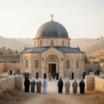
The Greek Orthodox site is especially recognizable by its red-domed church and landscaped grounds near the lake. It offers a different visual and devotional experience from the Franciscan archaeological park. Depending on the day and current access rules, visitors may be able to view the church grounds, shoreline, or exterior features.
The Franciscan area contains the principal excavated ruins, the ancient synagogue, and the modern church over the house traditionally linked with Peter. Religious sites may request modest clothing and respectful behavior. Services, pilgrim groups, or maintenance work can temporarily affect access to particular buildings.
Opening hours and admission policies can change. Check the current information from the relevant site authorities before setting out, especially on religious holidays, weekends, or days with heightened regional security measures.
How to reach Capernaum from Tiberias and northern Galilee
Most independent travelers reach Capernaum by car along the roads that follow the northern or western side of the Sea of Galilee. From Tiberias, the route heads north and then east toward the lakeside attractions. Road signs may identify Capernaum, Kfar Nahum, or the national park area.
Organized tours commonly combine Capernaum with Tabgha, the Mount of Beatitudes, and other religious sites around the lake. This option is efficient when you want historical context and coordinated transportation. Ask whether the itinerary includes entrance fees, time inside the archaeological area, and visits to both the Franciscan and Greek Orthodox compounds.
Public buses may serve parts of the Sea of Galilee region, but service frequency and the distance between stops can make a bus-only visit inconvenient. A final walk may involve roadside sections, heat, uneven ground, or limited shade. Confirm the current route with a local transit provider rather than assuming that a map app shows every seasonal change.
Travelers arriving from the north can approach through the Upper Galilee or Jordan Valley, depending on their starting point. From Jerusalem or Tel Aviv, Capernaum is normally a long day trip, and the journey may be tiring if you attempt to add many other attractions. An overnight stay around Tiberias allows more time at the archaeological site and the lake.
Practical visiting tips and common mistakes
Capernaum is compact, but a thoughtful plan makes the visit more comfortable and prevents common misunderstandings about the location. The ruins are exposed, and the surface can be uneven. Allow more time than the driving distance alone suggests if you want to examine the synagogue, domestic remains, churches, and shoreline.
Confirm the exact map pin: Use “Capernaum National Park” or “Kfar Nahum” and check that the route ends at the intended parking area.
Bring water and sun protection: The lakeshore can be hot, with limited shade across parts of the archaeological grounds.
Wear stable walking shoes: Ancient stone surfaces, gravel, steps, and uneven ground are common.
Check opening times: Religious compounds and archaeological attractions may follow different schedules.
Allow time for both history and worship: Do not assume the ruins and every church are managed as one attraction.
Dress respectfully: Cover shoulders and knees when entering churches or other active religious spaces.
Do not confuse nearby sites: Tabgha, the Mount of Beatitudes, and Capernaum are close but separate destinations.
Use caution at the shoreline: The lake edge may be rocky, slippery, or unsuitable for swimming in a particular area.
Planning tip: Visit Capernaum early in the day when temperatures are more manageable and organized pilgrimage groups may be smaller. Pair it with nearby Tabgha and the Mount of Beatitudes instead of crossing the region repeatedly.
One frequent mistake is assuming that every stone at the site belongs to the time of Jesus. Capernaum developed over several centuries, and visible structures may represent different phases of construction. A guide, site signage, or a reliable archaeological explanation can help separate the first-century village from later rebuilding.
Another mistake is treating the shoreline as a precise ancient boundary. The lake’s water level has varied, and modern landscaping, roads, and walls influence what visitors see today. The broad geographic setting is secure, but individual ancient waterfront features require careful interpretation.
When to visit Capernaum
The most comfortable seasons are generally spring and fall, when daytime conditions around the Sea of Galilee are often milder than in the hottest part of summer. Winter can bring pleasant sightseeing weather but also rain and occasional changes to outdoor access. Summer visits are possible, though early morning is usually preferable for walking among the exposed ruins.
Religious holidays can bring large crowds, and the busiest periods may include pilgrim groups from several countries. If you prefer a quieter visit, check local calendars and arrive near opening time. Always verify current conditions because access policies and regional travel guidance can change.
Sun protection is useful throughout the year. The lake reflects sunlight, and the archaeological area has open sections with little shade. Water, a hat, comfortable footwear, and modest clothing are simple additions that can make the visit more enjoyable.
What Capernaum reveals about ancient Galilee
The location helps explain why Capernaum appears so often in accounts of Galilee. The village stood beside a productive freshwater lake, near routes connecting different parts of the region. Fishing provided work and food, while the surrounding land supported agriculture and movement between communities.
Capernaum was also part of a wider network of Jewish settlements. Its synagogue, houses, ritual practices, and material culture belong to the religious and social world of ancient Galilee. The site should therefore be understood not only as a place connected with Jesus, but also as a community with its own residents, customs, work, and history.
The basalt architecture reflects the local geology, while the limestone synagogue shows access to materials and craftsmanship from beyond the immediate village. This combination reveals both local identity and regional connections. The remains do not provide a complete record of daily life, but they offer a rare, tangible view of a Galilean settlement from the periods surrounding the rise of Christianity.
Later Christian construction changed the physical appearance of the site while preserving its religious memory. Churches, pilgrimage routes, and archaeological excavations all contributed to the way Capernaum is experienced today. The modern visitor is seeing several historical layers at once: the ancient village, later religious buildings, and contemporary conservation work.
How to plan a Capernaum visit on a Sea of Galilee route
A practical route can begin in Tiberias and continue north along the lake to Capernaum, Tabgha, and the Mount of Beatitudes. After visiting the northern shore, you can return toward Tiberias or continue toward other destinations in Galilee. The order may change according to opening hours, tour schedules, and traffic.
Start with a map check: Confirm the Capernaum entrance, nearby parking, and the locations of the religious compounds.
Visit the archaeological remains: Set aside time for the synagogue, basalt houses, and the structure traditionally associated with Peter.
See the churches respectfully: Check whether services or visitor restrictions affect entry.
Continue to nearby sites: Tabgha and the Mount of Beatitudes fit naturally into the same northern lakeshore itinerary.
Build in flexibility: Leave time for walking, heat, traffic, and changes in access.
For travelers mainly interested in biblical geography, Capernaum works best when viewed alongside Nazareth, the Jordan River area, the Mount of Beatitudes, and other Galilean locations. For travelers focused on archaeology, the synagogue and domestic remains deserve a slower visit than a brief photo stop allows.
The essential geographic fact remains simple: Capernaum is an ancient lakeside settlement on the northwestern Sea of Galilee in Israel. Its proximity to Tiberias and other Galilean sites makes it accessible, while its archaeological remains and Gospel associations give the location unusual historical depth.
Frequently asked questions
Is Capernaum in Israel or Palestine?
Capernaum is in northern Israel, on the northwestern shore of the Sea of Galilee. It is located in the Galilee region and is administered as a visitor and archaeological site within Israel. The location is separate from the West Bank and from the city of Tiberias, although Tiberias is a common base for visiting it.
Can you visit Capernaum without a tour?
Yes. Independent visitors can reach Capernaum by private car, taxi, or selected public transportation routes. A tour is useful for coordinated transport and historical interpretation, but it is not required. Check current opening hours, entrance arrangements, and travel conditions before going, since nearby religious compounds may operate separately.
How much time should you spend at Capernaum?
Plan for at least one to two hours if you want to see the archaeological remains, synagogue, church over the traditional house of Peter, and nearby religious areas without rushing. Add more time if you are visiting during a busy period, walking from another attraction, or studying the site with a guide.
Is Capernaum the same place as Tiberias?
No. Capernaum is an ancient village and archaeological site on the northern Sea of Galilee shore. Tiberias is a modern city on the western shore, farther south, with hotels, restaurants, and transportation services. Travelers frequently stay in Tiberias and visit Capernaum as part of a day trip around the lake.






Leave a Reply